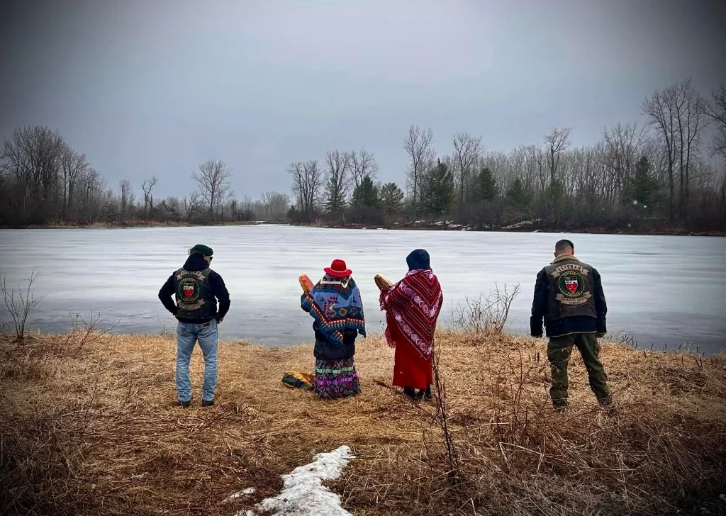
Dossier · Blainville · Laurentides · September 25, 2026
La tourbière qui se souvient
Indigenous history, ecology, and water territories around the Grande Tourbière de Blainville. Six thousand years of sphagnum moss, nations that never ceded this land, a river of a hundred islands, and a present still digging into the peat.
Non cédé · à lire avec nuanceComplexe tourbeux ~623 haSources ouvertes, pas un inventaire de terrain
00 · Mode d’emploi
A broad file, not a legend.
The broadest portrait that open sources allow us to write in 2026: the people, the peat bog, the surrounding water territories, the species. The thickness is over time. Nothing is invented to fill a silence.
DocumentéReported by the press based on official documentsReported by citizens or naturalistsContexte régional solideHabitat compatible, présence non prouvée iciTrou d’archive
What this file is
A civic and rigorous approach to documentary research. Each fact is linked to a verifiable source: public archives, ministries, BAPE (Québec Bureau of Public Environmental Hearings), journalistic investigations, ecological studies and direct transmissions. When data diverge, the contradiction is exposed with transparency and honesty.
What this file is not
It is neither a speaking out on behalf of the First Nations, nor an impersonal synthesis produced on an assembly line by algorithms. This document does not replace either the living memory of the elders, nor the sovereign teachings of the Clan Mothers of the Longhouse. Colonial archives have often obscured the indigenous presence on these lands; this work seeks to name this silence with humility, without ever inventing anything.
01 · Le lieu
A flat country, between river and mountain.
Blainville is a city in the Lower Laurentians, on the north shore of Montreal, in the MRC (regional county municipality) de Thérèse-De Blainville (Thérèse-De Blainville regional county municipality) and the Metropolitan Community of Montreal. It is located around 45°40′ north latitude and 73°53′ west longitude. Area: approximately 55 km². Population: 59,819 inhabitants at the 2021 census; 61,114 in 2024, according to the current encyclopedic record. Kind: Blainvillois, Blainvilloise. Mayor in 2026: Liza Poulin.
It’s not yet the mountain. This is the plain of the St. Lawrence Lowlands: marine clays, almost zero slope, water that does not find its slope. The Rivière aux Chiens, a tributary of the Rivière des Mille Îles, borders the south of the city. To the north and east, the wooded area continues towards Sainte-Anne-des-Plaines. To the west: Boisbriand, Sainte-Thérèse, then Saint-Eustache, Lac des Deux Montagnes, Oka and Kanehsatà:ke. To the south, on the other side of the river: Laval, Île Jésus.
40 %of municipal territory in natural spaces, according to the City
19,2km² de boisés
9,86km² de milieux humides
50,1km de cours d’eau
Source: Environment page of the Ville de Blainville (City of Blainville). Woodlands and wetlands partly overlap: a wooded peat bog can count in both.
The bog is not a point on a map. It is a complex: peat bogs, marshes, wooded and shrub swamps, wet meadows, connected to streams which end in the river. The ministry describes a group of approximately 622.7 hectares, included in the Atlas of territories of interest for conservation in the St. Lawrence Lowlands.
Fauvel Lakes
Public woodland of 97 ha, inaugurated in 2017. Marshes, wooded peat bogs, two bodies of water, trail of approximately 3.5 km. More than 100 species of birds announced by the City and its partners.
Bouchard map
Largely swampy woodland, footbridges, remains of a WWII munitions filling factory. The place where industrial warfare bit into the damp country.
Trail to Sainte-Anne
A cycle path crosses the area and connects Blainville to Sainte-Anne-des-Plaines. It is often through this that people discover the immensity of the peat bog – and, further on, the scars.
02 · Temps profond
Before names, there was a sea.
The bog was not “always there”. It is the last state of a hollow left by the ice, then by the sea, then by a lake.
vivant
S.E.M.
tourbe
lac
mer
Champlain Sea
At the end of the last glaciation, the Laurentide ice sheet retreated. The ground, still buried under the weight of the ice, allows the sea to enter. The Champlain Sea covers the Lowlands. The syntheses of Occhietti and Richard place this episode around 13,000 to 10,500 years before today, in calendar years, with variations depending on the sites and calibration. The entire Blainville plain was then under salt water. Whales once swam where bungalows grow today. During this interval, no human occupation is possible here: a seabed is not a camp.
Lake, then foam
The land rises, the sea recedes, and lakes remain trapped in marine clay, impermeable, sometimes sensitive: the clay of the Champlain Sea. The City and the ministry write that the large peat bogs in the Blainville woods could date back almost 6,000 years, and that the land targeted by Stablex is surrounded by large peat bogs “which could date back 6,000 years”. The precise carbon-14 dating of this specific complex remains to be documented by future university samples. This is an official estimate, consistent with the age of many lowland peatlands, which begins in the mid-Holocene, once the depressions were isolated.
How a bog is built
Sphagnum moss grows from the top and dies from the bottom. In cold, acidic, oxygen-poor water, decomposition slows down. Peat piles up from a few tenths of a millimeter to a few millimeters per year. In six millennia, this can create several meters of archive. An ombrotrophic peat bog ends up receiving only rainwater. A fen, or fen, remains nourished by soil water, richer in minerals. The Blainville complex combines the two, with marshes and swamps. Le Devoir, citing the documents in the file, describes an ecosystem of approximately 6.2 km²: marshes, wooded and shrub swamps, wet meadows and peat bogs.
A peatland is not a muddy swamp. It is a slow library: pollen, seeds, insects, carbon, and sometimes wood and artifacts, preserved because oxygen cannot penetrate.
Peatland ecology · Payette and Rochefort, 2001, and carbon sink function reaffirmed by the Ministry in 2024–2025
The ministry writes that, in addition to habitat, hydrological regulation, sediment capture, screening against wind and sun, and the landscape, “one of the important ecological functions to preserve is that of a carbon sink”. He adds that the planned activities threaten the sustainability of adjacent wetlands: hydrology, plant and microbial communities, water chemistry, soil quality. A specialist cited by Le Devoir recalls that visible degradation is very difficult to reverse, and that the disappearance of the complex could release the already sequestered carbon. The exact quantitative assessment of the tonnage of carbon stored in this complex is part of the independent environmental studies still to be investigated.
03 · Peuples
Several nations, the same country of water.
Two errors respond to each other. Assign the bog to a single people. Or start the story in 1683, with a lordship. A third would be to invent an oral story that no public source contains.
What “unassigned” means here
For the island of Montreal and the south of the Laurentians, there is no numbered treaty by which a nation ceded its title to the Crown, as in part of the West. The French lordships were granted without the consent that contemporary law would recognize. Kanien’kehá:ka traditional authorities maintain that their traditional territory was never ceded. The press, for the Kahnawà:ke nation, describes it as extending from the St. Lawrence Valley to the Adirondacks and northern New York State, including the Montreal region. McGill University, in its territorial recognition, names the Kanien’kehá:ka guardians of the lands and waters of Tiohtià:ke. An educational document from UQTR places the south of the Laurentians in the Kanien’kehá:ka ancestral territory, and the Weskarini, an Anishinabe group, further north, in the Hautes-Laurentides.
No court judgment says: “the peat bog lot belongs to such and such a community”. The fact, historical and political, is simpler. This country was not ceded by treaty. Several nations have attachments to it that overlap in time. Making it an exclusive queue would be wrong.
Kanien’kehá:ka
Autonym: the people of flint. In Kanien'kéha, the traditional longhouse people are the Kanonsonnkweonkwe (or Kannosonhkwe'ón:we; Rotinonhsón:ni), distinct from the Onondaga term Haudenosaunee. Guardians of the Eastern Gate. Nearby communities: Kanehsatà:ke (Oka), Kahnawà:ke (south of Montreal), Akwesasne. Tioweró:ton hunting territory, in the Laurentians, shared between Kahnawà:ke and Kanehsatà:ke. The southern Laurentians are described as part of their ancestral territory.
Anishinabeg, Nipissing, Abenaki
The Algonquins frequented Lac des Deux Montagnes and the Ottawa Valley. In 1674, Father Dalmas noted an “Algonquin cabin” on Île Jésus. The Nipissing joined the Oka mission in 1727. The Abenakis named the Mille Îles River Makigôtekw, the river of rakes.
St. Lawrence Iroquoians
Corn, squash and bean farmers, palisaded villages, including Hochelaga visited by Cartier in 1535. Their sites in the valley disappeared between Cartier and Champlain (1603). Open debate: war, epidemics, climate, adoption by the Wendat, the Haudenosaunee, the Algonquins, the Abenakis. They did not “disappear without leaving anyone behind”; they ceased to exist as a distinct nation on the river.
Wendat
Historical allies of the French, adversaries and then parents of the Haudenosaunee. Certain Wendat traditions, and the work of archaeologists, link some of the dispersed St. Lawrence Iroquoians to Wendat communities. Their direct presence on the Blainville peat bog is not documented. Their history sheds light on the region. She doesn't own it alone.
Distinction fondamentale : La Maison Longue (Gouvernance traditionnelle) vs Le système de bande
A major political and legal distinction separates the Longhouse (traditional sovereign governance, carried by the Clan Mothers, hereditary chiefs and the Great Law of Peace / Kaianerehkó:wa) from the system of band councils imposed by the British Crown and the Indian Act to administer the colonial regime. Bodies such as band councils or the Assembly of First Nations (AFN) are state creations which in no way replace the inherent sovereignty of the peoples of the Long House (Kanonsonnkweonkwe). To understand the political significance of this terminological and institutional distinction, see the webinar on traditional sovereignty and Kannosonhkwe'ón:we ↗. ↗
Pronounce
Name
Approximate meaning
Landmark
Kanien’kehá:ka
people of flint
gah-nyen-geh-HAH-gah
Kanonsonkweonkwe
people of the longhouse (kanien’kéha)
gah-noon-soon-gweh-OON-gweh
Tiohtià:ke
name kanien’kéha of Montreal
djoh-djah-geh
Kanehsatà:ke
often glossed “sandy place”
gah-neh-sah-TAH-geh
Kahnawà:ke
place of rapids
gah-nah-WAH-geh
Tioweró:ton
Laurentian hunting territory
dee-oh-weh-ROH-don
Haudenosaunee
people of the longhouse (onondaga)
ho-den-oh-SHO-nee
Skennen kowa
the Great Peace
SKEN-nen GO-wah
Makigotekw
rakes river, Abenaki name
mah-kee-GOH-tekw
Oka
Algonquin; “golden fish” or linked to chef Paul Oka
the sources diverge, the two traditions circulate
These pronunciations are benchmarks for a French-speaking ear, not a linguistic transcription. The spelling varies: Kanien’kehá:ka, Kanien’kéha, Kanehsatà:ke, Kanesatake, Kannosonhkwe’ón:we.
An indigenous timeline of the country around
Around 12,000 years ago
Paleoindian groups, hunters, entered southern Quebec as the ice retreated. The Blainville plain is still marine, or has just emerged. No camp can be placed there without proof.
Around 6,000 years ago
The Archaic intensifies in the valley: hunting, fishing, gathering, cut stone and polished stone. This is also the order of magnitude used for the start of the peat bog. Human history and plant history become contemporary, without a published archaeological site linking them to this precise location.
Around 3,000 BCE to 1000 CE
Artifacts associated with the Mille Îles River, unearthed during excavations mentioned for 1996, are estimated between 3000 BCE and the year 1000. The source is secondary: a general public synthesis based on the archeology of the river. The interval covers the Late Archaic and the Woodland: pottery, points, bank camps. The river is a road long before being a lordship.
Around 1000 to 1535 CE
In the valley, Iroquoian groups settled around corn. Hochelaga, on the island of Montreal, was a stockaded village of around a thousand people when Cartier passed there in 1535. The exact site remains debated. An open bog is not a village location: too wet, too acidic for corn. This is the hinterland. Hunting, berries, plants, water, refuge.
Around 1540–1603
The Iroquoian villages of the Saint Lawrence cease. Champlain, in 1603 and then in 1611, no longer found Hochelaga. In European sources, the river once again becomes a corridor of passage, more than a country of agricultural villages.
1637
The Jesuit Relations describe Île Jésus, then Île Montmagny, “beautiful and large”, bordered to the north by the Saint-Jean River – one of the ancient names of the Mille Îles River, associated with Jean Nicolet.
1674
Father Antoine Dalmas tours Jesus Island. He finds two indigenous camps. One is noted as an “Algonquin cabin”. The island serves as a stopover, especially in the summer, for the fur trade. Artifacts from these passages are still reported.
1680–1683
The colonization of Jesus Island stalled, partly because of Iroquois opposition. On September 24, 1683, according to the municipal timeline, Michel-Sidrac Dugué de Boisbriand received the lordship of Mille-Îles, from Terrebonne to the Rivière du Chêne, in Saint-Eustache. The Canadian Encyclopedia indicates 1673. Both dates are in circulation. The City retains 1683. A concession is not proof of an empty country.
1717–1727
The Sault-au-Récollet mission is moved to Lac des Deux Montagnes. In 1721, villages opened: Kanien'kehá:ka on one side, Algonquins and soon Nipissing on the other, under the Sulpicians. The king grants a lordship on the condition, according to several readings, that the lands are used by the Aboriginal people. The Sulpicians will then claim ownership. The conflict is not peripheral. It is the origin of Kanehsatà:ke, about thirty kilometers west of the peat bog. It will break out in 1990.
XVIIIe siècle
Algonquin converts from the mission often spent the winter on their hunting grounds in the Ottawa Valley, and the summer near the lake. The Kanien’kehá:ka of the mission remain more attached to the village. The south of the Laurentians is a country crossed, hunted, claimed. It is not a blank page between two clearings.
30 novembre 1837
Patriots from Saint-Eustache, led in particular by Amury Girod, marched towards Oka and Kanehsatà:ke to look for weapons and “disarm the savages”, according to judicial sources of the time. The same fall, a patriot expedition to Kahnawà:ke failed: the Kanien’kehá:ka captured the attackers and delivered them to Montreal. The school history of the Patriots often omits this chapter. However, it takes place on the same river.
14 décembre 1837
Battle of Saint-Eustache. Colborne attempts to cross the Mille Îles River. Nearly 70 Patriots were killed. The village is pillaged. The river is a battle line, not a setting.
1851–1853
Creation of the Doncaster reserve, Tioweró:ton, hunting and fishing territory in the Laurentians, for the use of the Mohawks of Kahnawà:ke and Kanesatake. It's not the bog. This is proof that the relationship with the Laurentian Forest did not end with the seigneurial regime.
11 juillet – 26 septembre 1990
Oka crisis, or Kanehsatà:ke resistance. A golf course and a residential project threaten a pine forest which includes a cemetery. Seventy-eight days. A police officer killed. The army. The Mercier Bridge blocked by Kahnawà:ke. The conflict comes from a title that has never been settled since 1717. Blainville is not Oka. It’s the same basin, and the same story: wet and wooded lands treated as empty, because a European land register saw neither the deaths nor the uses.
04 · Mémoire & Archives
Understanding colonial archives and honoring indigenous memory.
Conventional municipal stories traditionally begin with the seigneurial concession of 1683, Marie-Thérèse de Blainville or the Bouchard Plan, retracing an urban history of more than 300 years. However, the plant landscape and the memory of the territory extend over several millennia.
Three essential factors enable us to understand the nature of written archives:
A lifestyle that respects the environment. Wetlands and peatlands were used for hunting, seasonal gathering (small fruits, medicinal plants) and land or river routes. This respectful relationship with the land left a light mark on the landscape, without the construction of permanent sedentary structures in the swamp.
The prism of colonial archives. European chroniclers and missionaries mainly recorded the establishment of parishes, censives and trading posts, often perceiving wetlands as obstacles rather than nurturing ecosystems.
Future archaeological projects. The banks of the Rivière aux Chiens and the surroundings of the Mille Îles basin constitute areas of potential archaeological interest whose in-depth study must be considered in close consultation with the nations holding these lands.
Ecological study perspectives
The margins of the peat bog — drier cords, terraces of the Rivière aux Chiens, approaches to the Rivière des Mille Îles — represent major ecological transition zones. The heart of the peat complex constitutes a valuable paleoenvironmental archive: ancient pollens, sediments and traces of past ecosystems. The detailed analysis of pollen cores in Blainville represents an open area of scientific research to better understand the plant and climatic history of the Lower Laurentians.
Plants of the humid country, ancestral knowledge of the North-East
This table presents the ethnobotanical procession traditionally documented within several nations of the North-East for the species characteristic of these humid habitats:
Plant
Medium
Documented uses, on a national scale
Labrador tea Rhododendron groenlandicum
peat bogs, acidic undergrowth
Very widespread infusion. Leaves used against inflammation in many indigenous pharmacopoeias. Dyeing. Reported by local naturalist observers.
Cranberry Vaccinium oxycoccos and relatives
sphagnum carpet
Autumn fruit, eaten fresh, dried or integrated into pemmican. An emblematic food plant of peat bogs whose local presence is characteristic of this habitat.
Sphagnum Sphagnum
the very body of the bog
Several Northeastern nations used them for their natural absorbent and antiseptic properties. They constitute the living matter of the peat bog.
Cattail Typha
marshes, water edges
Food rhizome, pollen, leaves for mats and basketry. Plant present in marshes and minerotrophic borders.
Thuja / cedar Thuja occidentalis
minerotrophic swamps
Tree of great ceremonial, medicinal and purifying importance among the Haudenosaunee and Anishinabeg. Present in adjacent wet cedar groves.
Willows Salix
wet edges
Bark rich in salicin, traditionally used for its soothing and pain-relieving properties. Basketwork material.
Wild garlic Allium tricoccum
nearby rich maple groves
Vulnerable spring plant in Quebec, protected against commercial picking. Present in the rich woodlands of the Lower Laurentians near the complex.
05 · La rivière
Makigôtekw, the road that holds the whole country together.
The Mille Îles River is an outlet from Lac des Deux Montagnes, therefore from the Outaouais, to the Rivière des Prairies. Around 42 kilometers, a drop of around fifteen meters, around a hundred islands covering around 350 hectares. It forms the northern limit of Île Jésus. Without it, the peat bog is just a basin. With it, the Blainville wetland complex belongs to a living corridor, from Oka to Terrebonne.
In European sources, it was called the Saint-Jean River from the Relation of 1637, then the Jesus River, the La Chesnaye River, the Repentigny River, and Branch of the River Ottawa. The French name comes from “Mil Isles”, the archipelago between the lake and Terrebonne, fixed as the name of a watercourse in the 18th century. Boucault wrote “Milse Isle” in 1754. The Abenaki name, Makigôtekw, rakes river, is older than the seigneury. The "rakes" have been read as fisheries, or as the comb shape of channels between islands. Both readings remain glosses.
Wildlife refuge, 1998
Ten islands, 26.2 ha, in Laval and Rosemère, managed with Éco-Nature. Regulation which protects in particular the habitat of the map turtle, the brown snake, the wood duck and the Canada goose.
92 status species
The refuge and its partners target, among others, the copper redhorse, the river redhorse, the eastern sand darter, the channel darter, the grass shiner, the American water-willow, the least bittern, the Canada warbler, turtles, bats, and the monarch.
A fish that only exists here
The copper redhorse, Moxostoma hubbsi, is endemic to southwestern Quebec, endangered. Its critical habitat includes portions of the Mille Îles and Des Prairies rivers. He does not live in the bog. It lives in the river that drains it. Cutting one means impoverishing the other.
In 2016, La Revue de Terrebonne recalled an often cited figure: 99.9% of the Canadian population of American carmantine, a bank plant, is found along this watercourse. This is a widely publicized conservation fact. Before legal use, it remains to be re-verified in the official CDPNQ records.
Éco-Nature suggests that the Mille Îles River is home to more animal and plant species than Mont-Tremblant National Park. Mediation formula, not a statistical table reproduced here. The intuition holds: the wealth is in the islands, the seagrass beds and the riverside marshes, not in the altitude.
06 · La colonie arrive tard
The soft soil protected the bog. A time.
The seigneury of Mille-Îles encompasses what will become Saint-Eustache, Bois-des-Filion, Lorraine, Rosemère, Boisbriand, Sainte-Thérèse and Blainville. The City writes that it was necessary to wait until the second half of the 18th century for the territory of Blainville to open up, very gradually, under the leadership of Marie-Thérèse de Blainville, daughter of Louis-Jean-Baptiste Céloron de Blainville, and her husband Jean-Marie Nolan Lamarque. The first inhabitant often cited, along the river, is Joseph Phillion, whose name moved towards Bois-des-Filion.
Why so late, when Montreal was founded in 1642? Because it’s not easy wheat growing land. Forest, clay, stagnant water, distance and, in the 17th century, military insecurity. Peatlands are the last plots that agriculture desires. You don't plow a carpet of sphagnum moss. We bypass it, we drain it if we can, we despise it.
1792
Disagreement between Lord Hertel and Lordship Lamarque. The seigneury is split by the Grande Ligne, today Boulevard du Curé-Labelle, route 117. The Canadian Encyclopedia dates the episode to 1791 and speaks of a mill conflict. The north-south axis of the city comes from this dispute, not from an old published path.
1849–1855
Sainte-Thérèse became a municipality in 1849. The surrounding area was established as the parish of Sainte-Thérèse-de-Blainville. The modern municipal regime is established on a seigneurial land register.
1946–1949
Detachments: Boisbriand, Rosemère, Bois-des-Filion. Blainville is what remains, then what refuses to merge with Sainte-Thérèse.
29 juin 1968
City status, under the Boisvert administration. The municipal page remembers June 29. Secondary notices say June 14. Eight mayors since: Roger Boisvert, André De Carufel, Paul Mercier, Oneil Charron, Pierre Gingras, François Cantin, Richard Perreault, Liza Poulin.
The name of the city does not come from an indigenous toponym. It comes from an officer, Jean-Baptiste Céloron de Blainville. Renaming does not erase the previous country. This only makes it unreadable on signs.
07 · Guerre, camp, dépotoir
What we do with land deemed worthless.
The big turning point was not 1968. It was 1941. The federal government expropriated, in a few weeks, a huge piece of land in the parish to set up Plan Bouchard, a munitions filling complex. It is not an explosives factory in the strict sense, but an assembly workshop: tracer bullets, shells, bombs, mines, depth charges, torpedoes. Local sources speak of approximately 6,000 acres, some 339 buildings, and 6,000 to 8,000 workers. The Canadian Encyclopedia records 1939 and 6,000 employees. The numbers vary. The scale, no. A temporary industrial town grows in the damp woodland.
The war ended in 1945. The complex became Camp Bouchard, a depot and training camp, until around 1969 according to the encyclopedia. In 1981, the City acquired other federal acres and sold part of them to Stablex. Local heritage notices speak of 12 acres. The military site was decontaminated around 1995. This does not resolve the chemical story that begins next door.
Stablex, since 1983
A subsidiary linked to an American group, Stablex processes inorganic residual hazardous materials by stabilization and solidification, the Sealosafe process. The residues are mixed with cementitious binders, then buried. Five historic cells. Cell 6, planned on neighboring municipal land, would target more than eight million tonnes over around forty years, a horizon sometimes announced until 2067.
The bog as trash
Part of the complex was used as a dump. In October 2014, a citizen and municipal cleanup removed more than 61,000 liters of waste and seven hunting caches. Nest boxes are placed for the tree swallow, the northern flicker and the downy woodpecker. The tires and the ocher pools along the track have unwillingly become the landscape through which many discover the place.
There is a continuity, moral as well as administrative, between the seigneurial judgment (“useless for the plow”), the military judgment (“perfect for explosives, no one lives there”) and the industrial judgment (“site already disturbed, low value”). The BAPE and the studies commissioned by the company itself have cracked this latest judgment. They did not prevent it from becoming law.
08 · Le vivant
The species, with their degree of proof.
Each sheet carries its degree of proof. A magnificent plant cited in a petition does not have the weight of a fish counted in a report submitted to the ministry. Both deserve to be named. Not in the same voice.
Threatened and vulnerable species — Grande Tourbière de Blainville
Collaborative citizen science inventory documenting the presence, distribution and status of species observed in the peatland. New species recorded by naturalists and citizens are synchronized live below.
49 individuals in the inventory corrected for captures in the Stablex file. Small fish of ponds and slow-moving streams. Its abundance says: calm, warm water, not a trout river.
RapportéUmbra limi
Shadow of slime
4 captures. It is the emblematic fish of oxygen-poor peat bogs: it comes up to swallow the air. Finding it here is more telling than a fishing trophy. The corrected report specifies that no brook trout were caught.
RapportéCulaea inconstans
Five-spine stickleback
1 capture in the same patch. Kind of small vegetated environments. Le Devoir, citing company documents, also speaks of nine species of fish in the sector: the complete list of these nine names was not in the public extracts read for this file.
RégionMoxostoma hubbsi
Copper Knight
Endangered, endemic. Critical habitat in sections of the Mille Îles River, not in the acidic pools of the peat bog. The link is hydrological: what leaves the complex ends in its river.
Fish with status of the river refuge. They talk about the seagrass beds and the sandy bottoms of the corridor, not the carpet of sphagnum moss.
DocumentéSphagnum spp.
Sphagnum moss
The City and naturalist descriptions agree: the ancient lake was invaded by sphagnum moss. It’s not a species, it’s the profession of the place. Acidifies, fills with water, archives pollen, stores carbon.
PotentielAnchistea virginica
Virginia Woodwardie
Rare fern from the peat bogs of southern Quebec, likely to be designated. Ecological studies confirm a highly suitable habitat on the site, and field naturalists have reported observations to be documented during botanical monitoring.
PotentielCarex folliculata · Triadenum virginicum
Follicle sedge and Virginia St. John's wort
Targeted by the ministry in questions to Stablex, with precise inventory windows: sedge from mid-July to early October, St. John's wort from August to September, woodwardie from June to October. The fact that we require these passages speaks to the quality of the habitat, not yet the result.
SignaléSarracenia purpurea
Pitcher plant
Carnivorous plant emblematic of open peat bogs. The urns fill with rainwater and digest insects: an elegant response to soil without nitrogen. Much photographed by the defenders of the site. Not yet seen in a public ministerial table consulted here. Ecologically, its presence would be normal.
SignaléDrosera rotundifolia · D. intermedia
Rossolis
Two sundews, glue traps on round or spatulate leaves. Same logic as the pitcher plant: the nitrogen comes from midges, not from the soil. A single insect feeds the plant for weeks. Repeated citizen reports.
SignaléRhododendron groenlandicum
Labrador tea
Aromatic bog shrub. Leaves infused in much of the indigenous Northeast. If a single plant were to link the botanical record and the indigenous record, it would be this one — provided we do not invent an uncollected local ceremony for it.
The classic costume of a southern Quebec peat bog: cotton grass, kalmias, caliculated cassander, andromeda, cranberry, tamarack and sometimes black spruce on the mounds, red maple in the swamps. To be confirmed species by species. Do not check them off like an inventory.
RégionJusticia americana
American carmantine
Threatened riverbank plant, most of whose Canadian population is linked to the Mille Îles River. Immediate neighborhood, not the boggy heart.
SignaléHemidactylium scutatum
Four-toed salamander
Small, white belly with black stars, four toes on the hind legs. It lays eggs in sphagnum moss. Radio-Canada cited it in 2016 among the species with status in the Fauvel lakes corridor. A youth media shows her in 2026 as present in the Grande Tourbière (Great Peat Bog). Precarious status in Quebec. It is probably the signature animal of the place, pending a published inventory.
RapportéChrysemys picta
painted turtle
Le Devoir writes that the land intended to be razed is a habitat for the painted turtle, listed under Canada's Species at Risk Act. Supporting photo in the article of March 19, 2025. Presence among the most solid in the herpetological file.
SignaléChelydra serpentina
Snapping turtle
Large muddy bottom turtle, of concern in Canada. Citizen list of the sector, and species monitored by the river refuge. Credible. Not a capture cited in the ministerial extracts read.
RégionGraptemys geographica
Map turtle
River turtle, map on the shell, protected habitat in the refuge. Citizen lists also put it near the peat bog. Its true home is the current and the islands, where it winters at the bottom, protected from frost.
À nuancerGlyptemys insculpta
wood turtle
Threatened. Le Devoir cites it among the theoretically protected animals which risk being killed by the works, with a “like” which may only be an example of the category. It is not counted here as confirmed on the lot, as long as an inventory mention is not public.
Two status snakes, cited by the citizen appeals of April 2025. The spotted snake is also a target of the riverside refuge. The brown snake is named in the refuge regulations, not in the peat bog lists.
Rapporté~200 species in the sector
The sky of the complex
Nearly 200 species of birds recorded in the project area, according to Le Devoir. On the site itself, a ministerial report mentions 132 species, including 66% nesting and 34% probable or possible nesting. Families mentioned: warblers, ducks, woodpeckers, birds of prey, shorebirds, buntings, thrushes, herons. The Fauvel lakes alone are reported to have more than 100 species.
RapportéChordeiles minor
Common Nightjar
Threat. Named by Le Devoir among the endangered species recorded in the area. Niche on the ground, in openings. Spring deforestation falls exactly on schedule.
RapportéCardellina canadensis · Contopus virens
Canada Warbler and Eastern Pewee
Two undergrowth birds in decline, cited in the same article. The Canada warbler is also followed by the river refuge. Their presence says that the complex is not just a marsh: there is mature humid forest, or fairly continuous for these species.
RapportéGeothlypis trichas · Vireo solitarius
Common Yellowthroat, Blue-headed Vireo
The common yellowthroat is considered a potential nester in the area, in decline due to loss of habitat. The blue-headed vireo was photographed on the coveted ground. Neither are ornithologist’s curiosities: they are birds of forest continuity.
SignaléDolichonyx oryzivorus
Bobolink
Threatened, bird of wet meadows. Noted at Fauvel lakes by amateur ornithologists, and shown in 2026 by youth media as a Grande Tourbière species. The wastelands and meadows of the complex suit it better than the rounded bog.
SignaléIxobrychus exilis
Least bittern
The smallest heron, threatened, dependent on cattail marshes. Target of the riverside refuge and citizen lists in the area. Discreet to the point that you miss it if you don't listen at dawn.
RégionArdea herodias · Chaetura pelagica
Great blue heron, chimney swift
The great blue heron is commonplace and magnificent on the river; citizens also put it near ponds. The endangered chimney swift was cited in 2016 for the Fauvel corridor. It nests in chimneys and large hollow trees, not in sphagnum moss.
Fauvelnotes d’ornithologues
What we see at Fauvel lakes
Local notes, linked to eBird, mention kingfisher, kingfisher, tawny thrush, cuckoo, bobolink, melodious vireo, buntings, warblers, ducks, waders. This is a sample of a public park, not the secret of the inaccessible heart of the bog.
RapportéAlces alces
Moose
Le Devoir confirms the moose in the ecosystem of approximately 6.2 km². A moose in a suburban bog, half an hour from downtown, is already a political fact. He needs continuity. A landfill cell in the middle of the complex is a fracture, not the loss of “a few trees.”
Cited by petitions and naturalists. All ecologically expected. The beaver is also an engineer: its dams can maintain exactly the water level on which the peat bog depends. Killing it or drying up its pond is rewriting hydrology.
RégionMyotis · Perimyotis
Bats
Little brown bat, northern myotis, eastern pipistrelle: species at risk monitored in the wildlife corridor of the Mille Îles River. Swamps and mature woodlands constitute prime hunting grounds for these nocturnal insectivores.
RégionDanaus plexippus · Bombus affinis
Monarch and rusty-spotted bumblebee
Two status insects tracked on the Mille Îles River. The monarch needs milkweed, rather in an open environment than in an acidic bog. The rusty-patched bumblebee is on the brink of continental extinction. Mentioning them reminds us that the corridor does not stop at vertebrates.
What the number “742 species” cannot carry
A citizen mobilization in April 2025 claims that 742 species have been listed in the cell 6 sector. The figure is circulating. There is no official total in the ministerial documents cited by the press. The solid public totals are other: nearly 200 birds in the sector, 132 on the site in a report, nine fish mentioned in the sector, three species named in the catch correction, 97 hectares and more than 100 birds at Fauvel lakes, 92 species with status in the riverine refuge. A broad citizen inventory can be true without being quotable as a state figure. To reject it out of contempt, or to engrave it as truth, are two lazinesses.
Why is this living being “from the south” and “from the north” at the same time?
The peat bogs of the alluvial plain, like those of Lanoraie further east on the north shore, are refuges: they keep northern plants (dwarf birch, low willows) and southern plants (Virginia woodwardie) far from the heart of their area. Blainville is in the same natural province. This is why a suburban peat bog can contain flora that you would think were boreal, next to a highway. The comparison with the Tourbières-de-Lanoraie ecological reserve is the best mirror available: same family of environments, real protection there, industrial file here.
09 · Territoires adjacents
The country does not stop at the city sign.
Sainte-Anne-des-Plaines and Mirabel
The track and wetlands continue towards the north-east, in a long agricultural plain. Mirabel has lost immense wetlands to the benefit of the airport and crops. The Blainville complex is one of the last large connected pieces. Jérôme Dupras, ecological economist, reminded us: in a region which has already lost the majority of its natural environments, this sector is one of the rare areas of connectivity that remain.
Boisbriand, Rosemère, Lorraine, Sainte-Thérèse
Same lordship, same clay, same parish detachments from the 20th century. Rosemère touches the refuge of the islands. The Rosemère woodland and the footbridges to Darling Island are part of the same waterfront network. To think “Blainville only” is to cut living things in two.
Laval, Jesus Island
Algonquin stops attested in 1674. Bank archaeology. Today, Rivière-des-Mille-Îles Park is the most successful public gateway to understanding the corridor. Exploration center, kayaking, refuge islands. It is there, more than in a dump parking lot, that we see the redhorse, the map turtle, the great blue heron.
Saint-Eustache and Deux-Montagnes
1837. The river as a front. The church burned, the village pillaged. A few kilometers away, Kanehsatà:ke, already a century-old mission, already a contested title. School history separates “our” Patriots and “the” Natives. The terrain puts them on the same river, the same week.
Oka, Kanehsatà:ke, national park
Mission of 1721. Pine forest. Graveyard. Golf. 1990. Today, the Kanehsatà:ke powwow, one of the oldest in Quebec, and still young indigenous tourism in the Lower Laurentians. The Oka National Park occupies part of the landscape that the Sulpicians opened to resorts. To visit the park without knowing who owns the pine forest next door is to miss half the place.
Kahnawà:ke and Akwesasne
Not adjoining the bog, but parts of the same nation. Kahnawà:ke was born from a Jesuit seigneury of Sault-Saint-Louis, granted in 1680, since reduced. Current demands refuse to be confined within the seigniorial perimeter. When a Blainville petition says “this territory is unceded”, it takes up this position. It does not, in itself, create legal title to the municipal lot.
Terrebonne, Isle of Moulins
Where the Mille Îles River joins the Prairies. Bird sanctuary, seagrass beds, seasonal fishing ban to protect spawning, permanent ban on the copper redhorse. The blue route, a navigable route, reminds us that the Outaouais, the lake and the Mille Îles are a single route.
Lanoraie, the protected mirror
Tourbières-de-Lanoraie ecological reserve, in the alluvial plain, further east. Virginia woodwardie, dwarf birch, moose, beaver, some 140 species of birds, and a bog butterfly, the Lanoraie elfin. Proof that the State knows how to protect this type of environment when it decides to do so. Proof, too, of what a complete inventory can reveal once it is financed.
10 · Le présent
2023–2026: the peat bog enters history through injury.
2023
Stablex submits the rearrangement of cell 6. The BAPE holds a hearing. Report 371, submitted on September 8, 2023, notes that the land is part of a corridor connecting two wetland complexes deemed exceptional, and that the project would fragment it. The commission does not recommend authorization. In September, the City adopted an ecological transition plan which calls for the protection of peatlands.
2024
Expert opinion from the ministry, June 2024, published only on April 4, 2025: the adjacent wetlands have a high ecological value, a large part of which is included in the Lowlands Atlas. The ministry writes in black and white the risk to the sustainability of the complex.
Printemps 2025
Despite the BAPE, Quebec tabled a special law, referred to in the press as the Loi 93 (Bill 93), and forced the City to cede the land. Minister Maïté Blanchette-Vézina states on several occasions that this is an industrial site without a peat bog “for a long time”. The Englobe study, obtained by Le Devoir, describes 278,046 m² of wetlands on the ground, including 97,237 m² of peatlands, approximately double the wetland area destroyed in the Northvolt file, a comparison made by the newspaper. The table of ecological functions from the same study gives a high yield to the site's peatlands for biodiversity, climate, water regulation and natural screen. However, Stablex speaks of “low ecological value”.
Mars–avril 2025
Blainville and the CMM contest. An alternative proposal would have added 123 hectares of protected wetlands on municipal land, to consolidate the Grande Tourbière. The Court rejects the request for an injunction. The call follows. The destruction work begins. The decree still requires an update of the wildlife inventory: at the time of authorization, the State did not have all the data. Fisheries and Oceans Canada indicated in March that federal authorization for fish habitat had not been requested. The ministry then requires at least fifteen years of monitoring of the impacts on adjacent environments.
2025–2026
The “Save the Grande Tourbière” petition has around 47,000 signatures at the beginning of 2026. Dozens of municipalities and the UMQ support Blainville. Scientists sign letters. On April 8, 2025, Le Devoir headlines on the peat bog several thousand years old. In 2026, William Guindon, then a teenager, filed a complaint with the Office of the United Nations High Commissioner for Human Rights, on behalf of future generations, after having exhausted, he says, the remedies here. La Presse meets him on July 3, 2026 in the Fauvel lakes woodland. The Aces of Info present him at 14 years old in July 2026. The official site then says he is 15 years old.
June 2026
Le Devoir reports that water and sediment samples, taken by Climat Québec and the Coalition of Blainville Citizens near the plant, contain several toxic metals. Citizen campaign relayed by a major daily newspaper, not a conclusion from the ministry. It is enough to say that the chemical question is not theoretical, and that it goes beyond deforestation alone.
The projected site is surrounded by large peatlands dating back up to 6,000 years. Together, they form a wetland complex estimated at 622.7 hectares.
Ministry of the Environment, environmental analysis report, cited by Le Devoir, April 8, 2025
The government's position, to be fair, can be summed up in three sentences. Quebec would need a capacity to bury stabilized hazardous materials, with cell 5 approaching its end. The land belonging to the City would, according to the minister, already be industrial. The special law would avoid a “break in service”. The position of the studies, including those of the ministry and the company's agent, is based on three others. There is peat bog on and around the lot. It is exceptional on the scale of the Lowlands. Destroying it or drying it out is not reversible on the scale of a human life, or even several.
11 · Perspectives de recherche
Knowledge and data to deepen together.
Données environnementales à approfondir
Radiocarbon dating of the base of the peat bog, exhaustive pollen diagrams, precise assessment of the carbon stock and the complete floristic inventory are among the essential independent scientific projects to be pursued to protect this environment.
Respect for traditional knowledge and oral transmission
The ancestral toponymy and living history of these lands are part of the oral tradition of the families of Kanehsatà:ke, Kahnawà:ke and surrounding nations. This traditional knowledge is not measured by the yardstick of colonial administrative archives: it is listened to from communities, with full respect for their sovereignty.
A program, if anyone wants to continue
Gesture
For what
With whom
Peat core, dating, pollen, macroremains
Transform “around 6000 years” into a real history of climate, fires, land clearings
University laboratory, and agreement on sampling: a core is a wound, even a small one
Request for the Inventory of Archaeological Sites in Quebec
Know what is already recorded on the banks of the Rivière aux Chiens and Mille Îles, without inventing villages
Archaeologists, and nations concerned before any excavation
Oral history
The silence of archives is not the silence of families
Kanehsatà:ke, Kahnawà:ke, Algonquin communities of Lac des Deux Montagnes. On their terms, not extraction
Publish inventories
Remove cash from “reported” or “industrial secret” status
Ministry, City, naturalists, eBird, iNaturalist
Independent hydrological monitoring
The ministry requires 15 years of follow-up from the company. Monitoring that does not depend on the promoter changes trust
University, CMM, watershed groups
Where to walk without harming the ecosystem
Boisé des lacs Fauvel, rue Legault and rue Omer-DeSerres: the fairest public threshold. Boisé du Plan Bouchard: war and swamp in the same path. Parc de la Rivière-des-Mille-Îles, in Laval: the corridor in readable version. Kanehsatà:ke: only by what the community offers, powwow, market, indigenous tourism, and not by going to “see the pine forest” as a setting. Do not enter the industrial site. Do not leave the footbridges during the nesting period. Do not pick. The pitcher plant is not a memory.
12 · Sources
Where does each floor come from?
Research stopped on September 25, 2026. Open sources, in French and English. The PDFs of the environmental register and the BAPE vault are cited by the public extracts and by the articles which reproduce them. They have not all been reread page by page.
Ville de Blainville, pages History, Environment, Blainville tells. Concession of 1683, city status on June 29, 1968, 19.2 km² of wooded areas, 9.86 km² of wetlands, peat bogs “which could date back almost 6,000 years”.
Statistics Canada, 2021 census, Blainville subdivision: 59,819 inhabitants, 54.97 km² of land area in the file consulted.
Le Devoir, Alexandre Shields, March to April 2025, notably the articles of March 19, March 28, April 2, April 3 and April 8, 2025, on wetlands, fish, birds, the ministerial report and the 6,000-year-old peat bog. Article from June 12, 2026 on metals in citizen samples.
Ministry of the Environment, environmental analysis report and expert opinion of June 2024, file 3211-21-014, cited by Le Devoir. 622.7 ha complex, high ecological value, Lowlands Atlas, carbon sink, 15-year monitoring.
Englobe, 2023-2024 characterizations filed for Stablex, cited by Le Devoir and the register: 278,046 m² of wetlands including 97,237 m² of peat bogs; high ecological functions; potential habitats for woodwardie, follicle sedge, Virginia St. John's wort.
Correction to the file, environmental register, document 3211-21-014-13: catches of fathead minnow (49), mud umbre (4), five-spined stickleback (1); no brook trout.
BAPE, report 371, investigation into cell 6, submitted in September 2023. Recommendation not to authorize; fragmentation of a corridor between two exceptional complexes. Vault of BAPE.
La Presse, Valérie Simard, July 3, 2026, “Protection of a peat bog in Blainville. A teenager's fight at the UN.
Les As de l’info, July 17, 2026, interview with William Guindon; four-toed salamander and bobolink.
Radio-Canada / RCI, 2016, Fauvel lakes, four-toed salamander, chimney swift. Echo of the North Shore, 2014 cleanup. Hydro-Québec Foundation and Nature-Action Québec, 2017 inauguration.
Stories from home / Virtual museum, Prairie and Thousand Islands rivers: Dalmas 1674, Algonquin cabin, artifacts.
Wikiworld and toponymic notices, Mille Îles River: Makigôtekw, artifacts estimated from 3000 BCE to 1000, to be treated as secondary synthesis.
Wikipedia and municipal notices of Oka; pages on Kanesatake and the 1990 crisis; Kahnawake, claim to the seigneury of Sault-Saint-Louis and unceded traditional territory, Radio-Canada Indigenous Spaces, 2021.
McGill, Indigenous Initiatives, recognition of Tiohtià:ke. UQTR, educational document Laurentides 2025, Weskarini and Kanien’kehá:ka ancestral territory to the south.
Tourism Basses-Laurentides, pages on Kanehsatà:ke. Politics of Tioweró:ton, Kahnawà:ke.
1837.qc.ca and chronologies of the Patriots: march of November 30, 1837 towards Oka, expedition towards Kahnawà:ke, battle of Saint-Eustache on December 14.
Rivière-des-Mille-Îles Wildlife Refuge, Wikipedia and Éco-Nature; DFO advice on critical habitat for the copper redhorse.
Tourbières-de-Lanoraie ecological reserve, file MELCCFP (Québec Ministry of the Environment, the Fight against Climate Change, Wildlife and Parks), as a protected analogue.
Payette and Rochefort (dir.), Ecology of Quebec-Labrador peatlands, Presses de l'Université Laval, 2001. Occhietti and Richard, 2003, chronology of the Champlain Sea. Archéo-Québec, prehistory of Quebec. Marie-Victorin, Flore laurentienne, 1935, for the name of the Hochelaga archipelago.
Change.org and citizen pages of the Grande Tourbière: lists of species, to be read as reports, not as a certified inventory. The figure of 742 species remains unverified.
Waymarking and local heritage notices on the Bouchard Plan: useful for the scale of the military complex, to be cross-checked with federal archives before specific historical use.
Édith Mora Castelan, direct details on traditional Kanien'kehá:ka governance, the fundamental distinction between the Longhouse (Clan Mothers, Kanonsonnkweonkwe / Kannosonhkwe'ón:we) and the band system imposed by the Indian Act, and explanatory webinar (video recording ↗). ↗
Approach, active listening, and primacy of traditional knowledge
This file is a citizen documentary research carried out in a spirit of sincere solidarity and deep respect for indigenous peoples. It never replaces the voice of nations, traditional councils of the Long House or elders. Any correction, toponymic precision or transmission from communities and knowledge keepers absolutely takes precedence over this text and is welcomed with humility and gratitude.